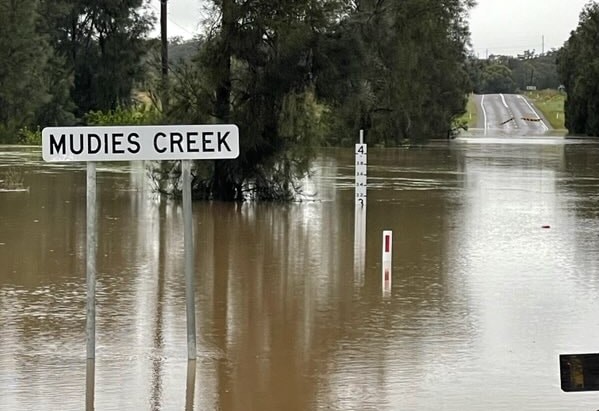
As a week of wet and cold weather continues across NSW, the focus is shifting to the southeast of the state after parts of the northeast and central west received a month’s worth of rain in a few days.
Even the Hunter hasn’t escaped the attention.
“The catchments are really saturated, the dams are full. That makes the rivers really sensitive,” Bureau of Meteorology senior meteorologist Jane Golding said.
The SES responded to more than 300 requests for assistance in the past 24 hours, with the majority coming from the central west including Orange, Bathurst and Young.
A potential evacuation was on the cards for about 15 homes in Georges Plains south of Bathurst but SES deputy commissioner Daniel Austin said “that threat has reset”.
The service is still “keeping a very close eye” on communities in the Lachlan River catchments as it has been for some months.
“That catchment particularly has been quite sodden for a long time,” Mr Austin said.
“In some places the floodwaters will recede and the ground may dry a little bit.
“We know the underlying ground is still saturated, so it doesn’t take a lot now for any more rainfall to run off.”
The rivers may also continue to rise even once the rain stops as water flows into the catchment.
“Don’t be fooled by blue sky, it doesn’t mean the risk is over … people can get into trouble,” Mr Austin said.
The SES conducted nine flood rescues since about midnight on Thursday, largely for cars in floodwaters.
“A lot of people after many months of lockdown have decided to hit the road. We ask them to be especially vigilant, we don’t need you to put yourself at risk and we don’t need you to put rescuers at risk as well,” Mr Austin said.
NSW is in for another day of heavy rain and thunderstorms ahead of conditions predicted to ease over the weekend, as some parts receive more than a month’s worth of rain in days.
Colder temperatures, showers, and gusty west to nor’westerly winds are expected around the state on Friday.
On Thursday Dubbo was hit with 43mm, with most of it falling in 30 minutes.
Up to 9am on Friday, Bunnan in the Upper Hunter recorded 99mm, Mount Palmer recorded 95mm and Merewether in Newcastle recorded 88mm, while Orange received 77mm.
Cessnock (63mm), Lake Macquarie (57mm), Lord Howe Island (51mm), Cowra (49mm), Bathurst (46mm), Goulburn (44mm) and Nowra (39mm) also received significant falls.
The Gwydir River peaked at 6.75m on Thursday afternoon before receding to around 6.11m at Gravesend, causing some minor flooding.
Flood warnings are in place for the Lachlan River at Nanami, the Gwydir River at Gravesend, Pallamallawa, and Yarraman Bridge, and the Mehi River at Moree.
A severe thunderstorm warning in place on Friday morning for Canberra, Cooma, Yass, Wagga Wagga, Young and Tumbarumba has been cancelled.
The Bureau of Meteorology warned sheep graziers the weather may be so bad their stock might not survive the day.
Get all the latest Newcastle news, sport, entertainment, lifestyle, competitions and more delivered straight to your inbox with the Newcastle Weekly Daily Newsletter. Sign up here.


